
Moroccan coastline monitored by drones
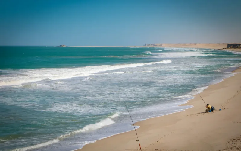
The Ministry of Equipment is launching a project to monitor the Moroccan coastline using drones. This technical program, with a budget of 500,000 dirhams, aims to track erosion and marine submersion in four strategic regions of the Kingdom, from the Oriental to Casablanca.
The Directorate of Ports and the Maritime Public Domain has launched a national call for tenders for this pioneering technological project. With an envelope of 500,000 dirhams, the initiative primarily targets sensitive areas and construction sites in the regions of the Oriental, Tanger-Tétouan-Al Hoceïma, Rabat-Salé-Kénitra and Casablanca-Settat.
On Bladi.net: "Made in Morocco" drones: the giant factory in Benslimane will be ready by 2026
The drones will have to provide high-precision aerial images, with a ground resolution of 6 centimeters per pixel. This data will be used to generate three-dimensional models and detailed topographic maps, incorporating the relief and existing structures with a planimetric and altimetric accuracy of 10 centimeters.
The program is divided into three technical missions, including the creation of reference databases and the analysis of the evolution of the coastline compared to administrative archives. Experts will be tasked with calculating the "cubatures" to precisely measure the volume of sand and material movements on the coastline.
On Bladi.net: Military independence: What the Benslimane factory will change for the Royal Armed Forces
The execution of this contract requires the mobilization of surveyor-topographer engineers equipped with specialized drones and dual-frequency GPS. The successful bidder will have to obtain all the legal flight authorizations before each intervention and undertake to archive all the digital data collected for a minimum period of five years.
Related Articles
-
220 dirhams on construction sites, up to 400 in the fields: Morocco lacks workers
25 August 2026
-
This Israeli company equips defense giants and also has clients in Morocco
24 August 2026
-
After three days in Algeria, a sanctioned Russian ship passes near Morocco
24 August 2026
-

In Brussels, a Moroccan name and being over 50: the profile most disadvantaged in hiring
24 August 2026
-

Morocco Has a New Billionaire Forbes Has Yet to Spot
24 August 2026